blah blah blah
Ethan Pond
Length: 5.4 miles out-and-backDifficulty (click for info): Moderate
Elevation Gain: 1510 feet (+100 feet on return)
Rating (click for info): 7/10
Elevation: 2837'
Driving Directions:
Trailhead and parking area are on Willey House Station Road in Harts Location, NH (pond is in Bethlehem). This road leaves Rt. 302 12.2 miles southeast of Rt. 3 and 16.8 miles west and northwest of Rt. 16. Look for the entrance at a state park sign for Ripley Falls on the south side of the road, a mile south of the Willey House and just west of a bridge over Avalanche Brook. Drive 0.3 miles up the road to the lot at the end. If there is no parking here, it is an option to park at the base of the road and walk up. In winter, the road is not plowed and the only parking is at the base. Click here for a Google map.
About the Hike:
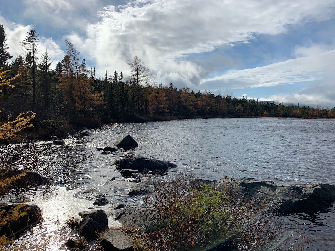
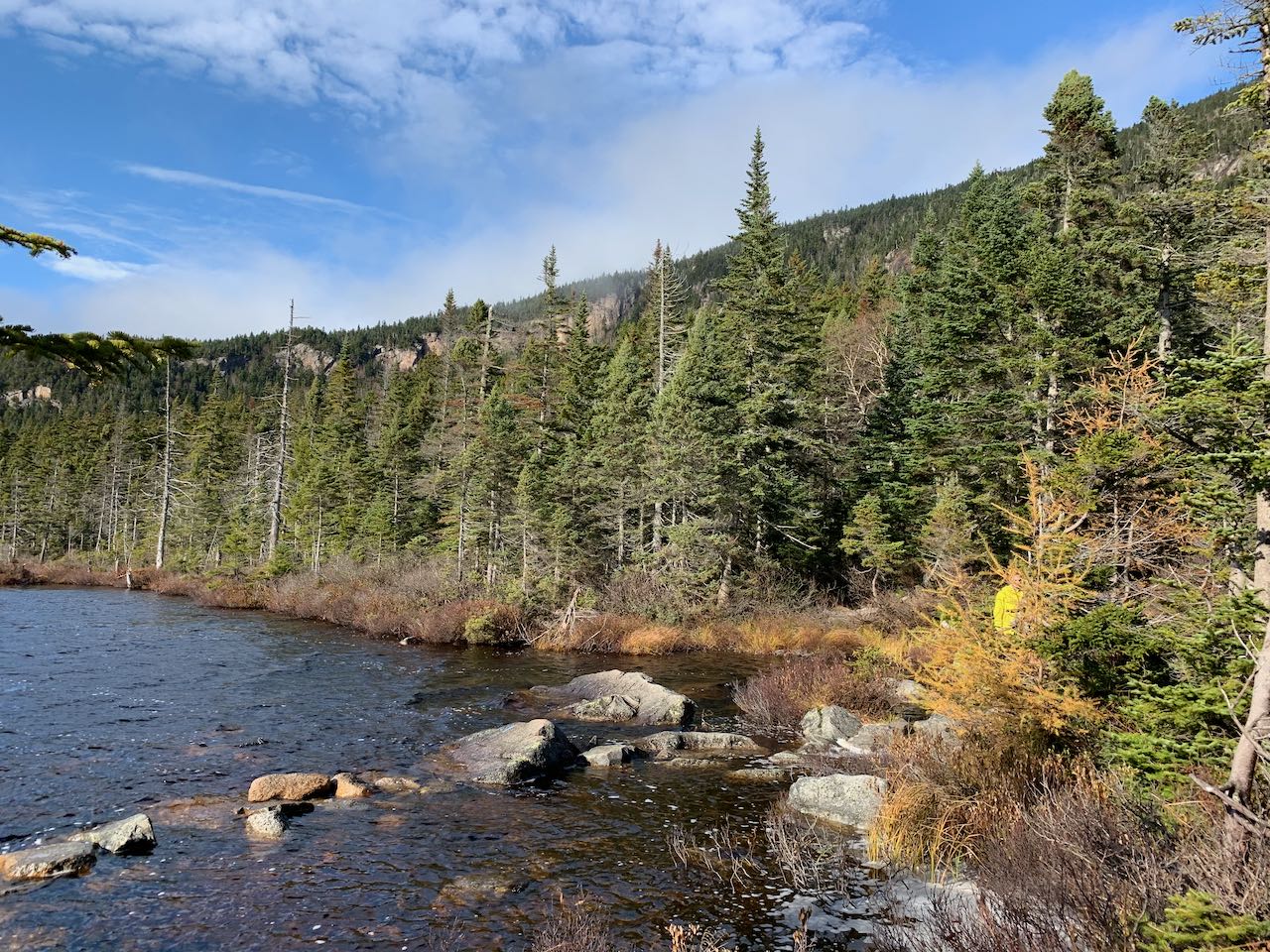
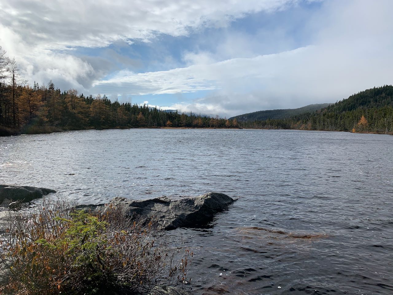
Ethan Pond is one of the most pristine wilderness lakes in the White Mountains. Located on a plateau that divides the river basins of the Pemigewasset and Saco River, the secluded shoreline features views into the great Pemigewasset Wilderness over the clear, quiet waters. A shelter by the pond offers a lodging place for Appalachian Trail hikers on their way through the Ethan Pond Trail, itself a short segment of the A.T. It's a moderate two and a half mile hike to get to the pond from the closest trailhead, which also serves visitors to Ripley Falls and Mt. Willey hikers. Near the end of the hike, you'll experience a sample of the unique boggy conifer forest found on this terrain.
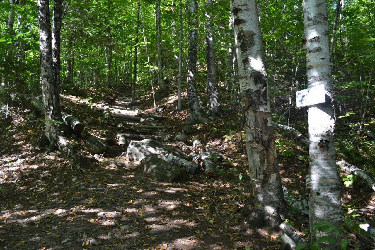
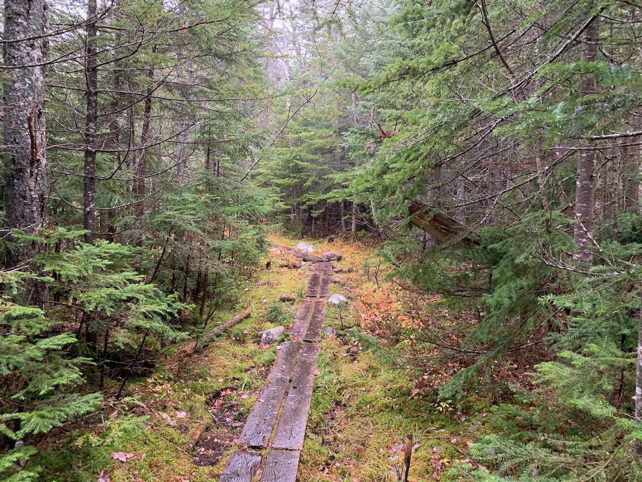
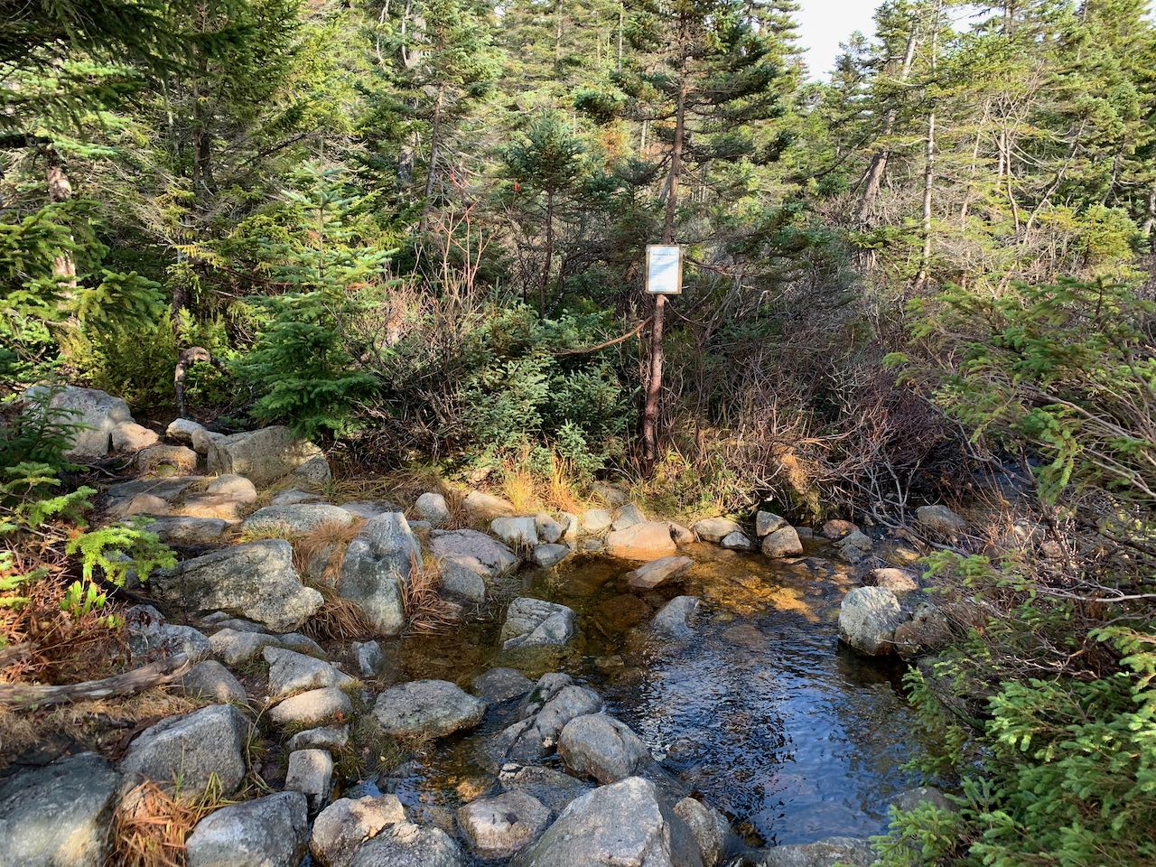
From the parking area, begin your hike on the Ethan Pond Trail. The trail nears Avalanche Brook, the source of Ripley Falls, then climbs to and crosses the tracks of the Conway Scenic Railroad, from which there is a slight view up to the looming summit of Mt. Willey. A moderate climb of 0.15 miles over rocky steps leads to the junction with Arethusa-Ripley Falls Trail. Ripley Falls is only a short 0.35 miles to the left and well worth visiting. Continue up the Ethan Pond Trail. It makes a steep, steady climb up a very long dirt-and-log staircase, then eventually moderates and traverses easier terrain for a while. A few seasonal streams are crossed. After a mile, pass Kedron Flume Trail on the right. Continue 0.3 miles, and arrive at the southern end of the Willey Range Trail. Take a left at this junction to stay on Ethan Pond Trail. The trail climbs moderately through spruce and birch forest for about a quarter mile before it starts to level off. It then spends 0.6 miles wandering across the broad plateau situated just below the sharp cone of Mt. Willey which divides the Saco River basin from the Pemigewasset River basin. With gnarly spruce thickets on each side, the trail crosses over extensive boggy terrain, where log bridges provide footing over the spongey moss. After crossing over the barely noticeable height of the plateau, the trail begins to descend into the eastern side of the vast Pemigewasset Wilderness. Chains of log bridges continue and alternate with some drier ground. After 0.15 miles, arrive at the junction with the spur to Ethan Pond. Take a right here and follow the path for little under 0.1 miles and cross the inlet stream to the pond on a bridge of stepping stones. This small brook, which flows down from a smaller pond up near the top of the plateau, is one of many streams in the eastern Pemi that, depending on which of them has the most volume, could be considered the infant Pemigewasset/Merrimack River. The trail leads out to a nice area of rocks on the east end of the oval-shaped pond, where there is plenty of room to take a seat and enjoy the scenery of the beautiful dark waters. In the background there is a view of Mt. Bond on the right and Mt. Hancock on the left. The craggy cliffs on the ridge rising up to Mt. Willey on the north side of the pond create a wild contrast with the gentle terrain around the plateau. The spur path continues a bit past the pond up the hill to a shelter. For a more intense wilderness experience, continue on the main trail to Thoreau Falls.
Printable directions page